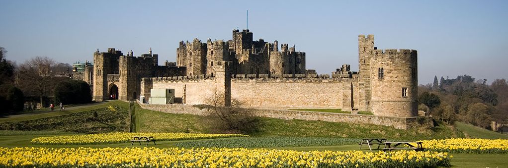
"The Windsor Castle of the North"
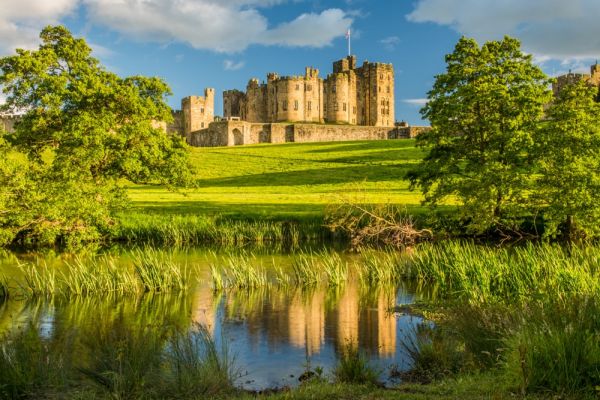
Alnwick Castle, which holds one of the world's most important collections of maps of the American Revolution, was used as a film set for the early Harry Potter movies.
The second largest inhabited castle in England next to Windsor Castle, it overlooks the River Aln in Northumberland, England, about 30 miles south of the border with Scotland. From the time of the Norman Conquest, there has been a castle on the site to hinder Scottish invasions.
Since the 13th Century, Alnwick has been the home of the Percy family and later the Dukes of Northumberland.
In addition to the Harry Potter films, the castle has appeared in such films and shows as Ridley Scott’s Robin Hood, Elizabeth (starring Cate Blanchett), the British sitcom Blackadder, and the Downtown Abbey TV series, among many others.
,
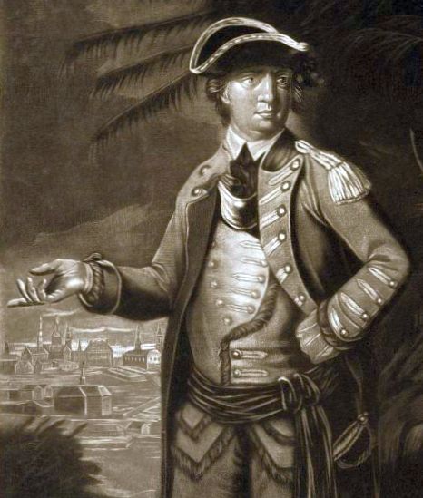
The 2nd Duke of Northumberland Collected Maps of Battles He Fought In
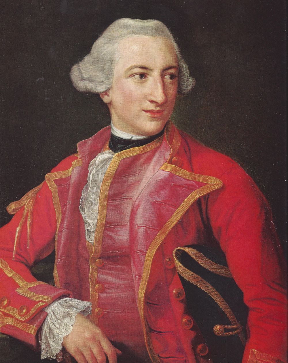
Lt. Gen. Hugh Percy, the 2nd Duke of Northumberland (1742–1817) was an officer in the British army and later a British peer. He fought at the battles of Lexington, Concord, Long Island, and Fort Washington during the Revolution, and is widely credited with saving the British forces who were ambushed at Concord by rushing reinforcements to the battle.
Percy joined the British Army as a teenager and fought with distinction in numerous conflicts. A Whig who sympathized with the Colonists to a degree, resigned his command in 1777 due to disagreements with his superior, General William Howe. Percy returned to England with his priceless of maps of the battles in which he had fought. They still remain in the family.
,
The Duke of Northumberland Invited American Heritage to Photograph His Collection
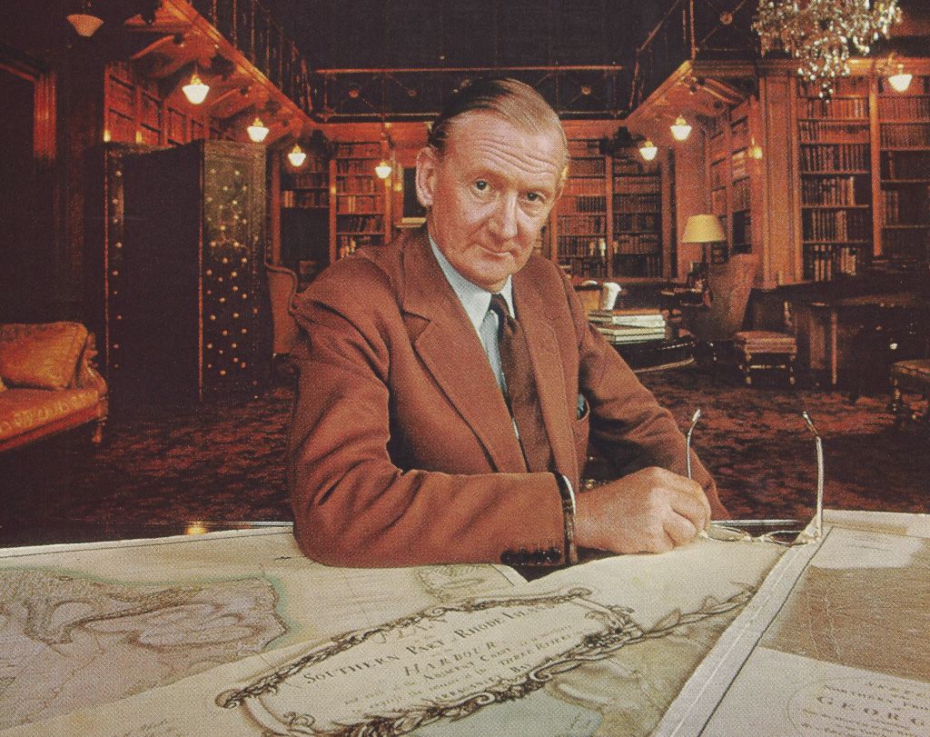
The 11th Duke of Northumberland invited a team from American Heritage to photograph and help catalogue his priceless collection of maps. In 1969 some of the most important maps were published in American Heritage for the first time.
Return to “Rediscovering Hand-Drawn Maps from the Revolution and the English Duke Who Collected Them,” by Edwin S. Grosvenor, American Heritage, Summer 2019
Return to “The Treasure of Alnwick Castle,” by Elizabeth and William Cumming, American Heritage, August 1969
,
A Secret Family Resemblance?
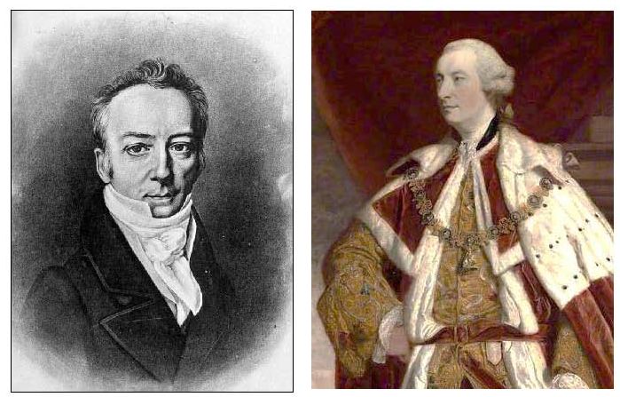
James Smithson (left), whose bequest founded the Smithsonian Institution, was the illegitimate son of Langdale Smithson of Langdale, Yorkshire — and the half-brother of Hugh Percy (right), the first Duke of Northumberland.
Percy (1714–1786) was an English peer, landowner, and art patron. He was actually born Hugh Smithson, a legitimate son of Langdale Smithson. After Hugh married Lady Elizabeth Seymour, the Baroness Percy, he changed his name to Percy.
The Percy family has lived in Alnwich Castle for centuries.
Return to “Rediscovering Hand-Drawn Maps from the Revolution and the English Duke Who Collected Them,” by Edwin S. Grosvenor, American Heritage, Summer 2019
,
Does the Smithsonian Castle Resemble Alnwick?
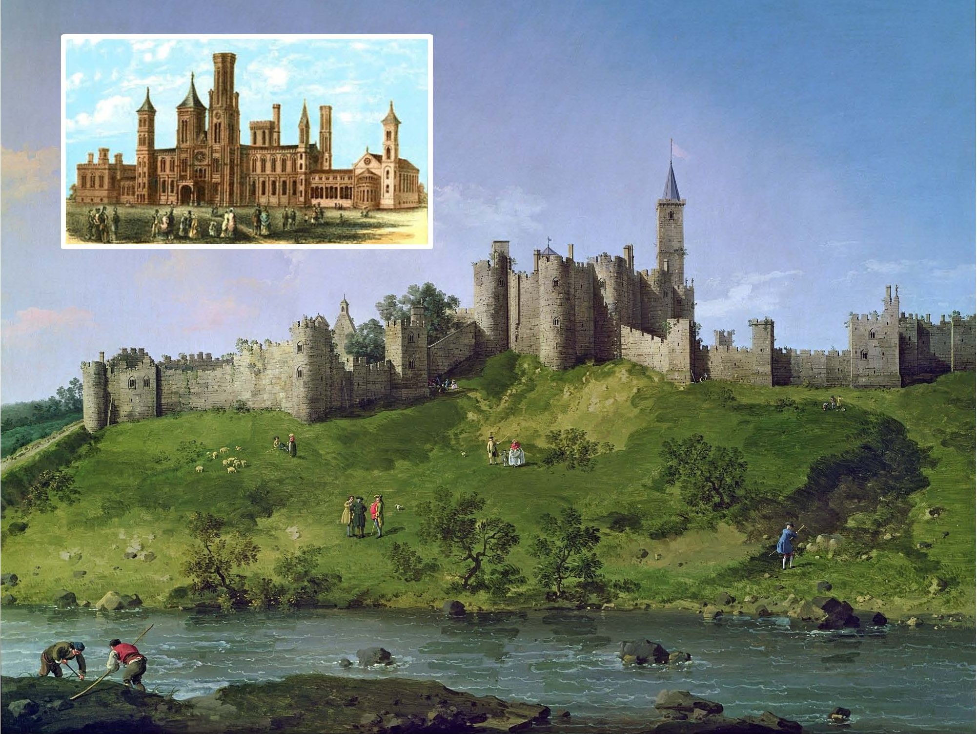
The Italian artist Canaletto painted Alnwick Castle in the 18th-century.
In 1838 the U.S. accepted a posthumous bequest of $508,318 from James Smithson, the illegitimate cousin of the Duke of Northumberland. Perhaps it was not a coincidence that the original Smithsonian Castle (inset upper left) bore a distant resemblance to Alnwick Castle.
Return to “Rediscovering Hand-Drawn Maps from the Revolution and the English Duke Who Collected Them,” by Edwin S. Grosvenor, American Heritage, Summer 2019
Return to “The Treasure of Alnwick Castle,” by Elizabeth and William Cumming, American Heritage, August 1969
,
The Earliest Known Maps of the Fights at Lexington and Concord
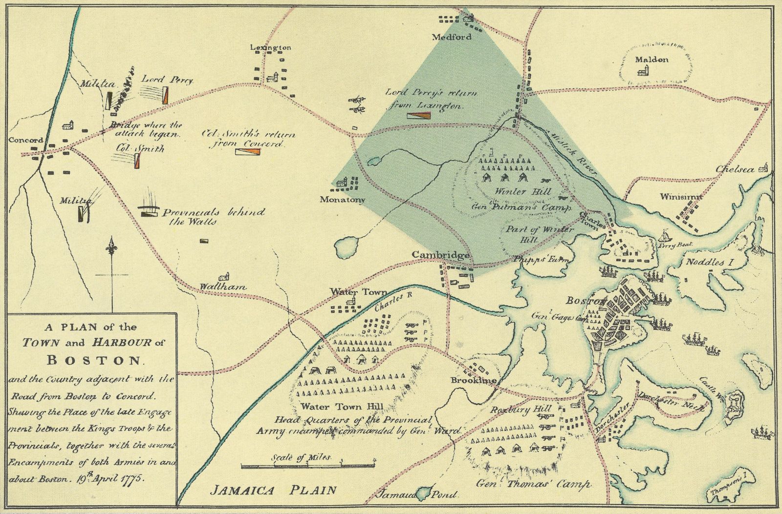
Two of Alnwick’s greatest treasures are the unsigned manuscript “A Plan of the Town and Harbor of Boston” above and the rough pencil sketch (next slide), which covers the shaded area in the Plan. Drawn not long after the events, they are the earliest known British maps of the retreat from Concord on April 19, 1775.
,
A Sketch from the Time Gives Key Information about Lexington and Concord
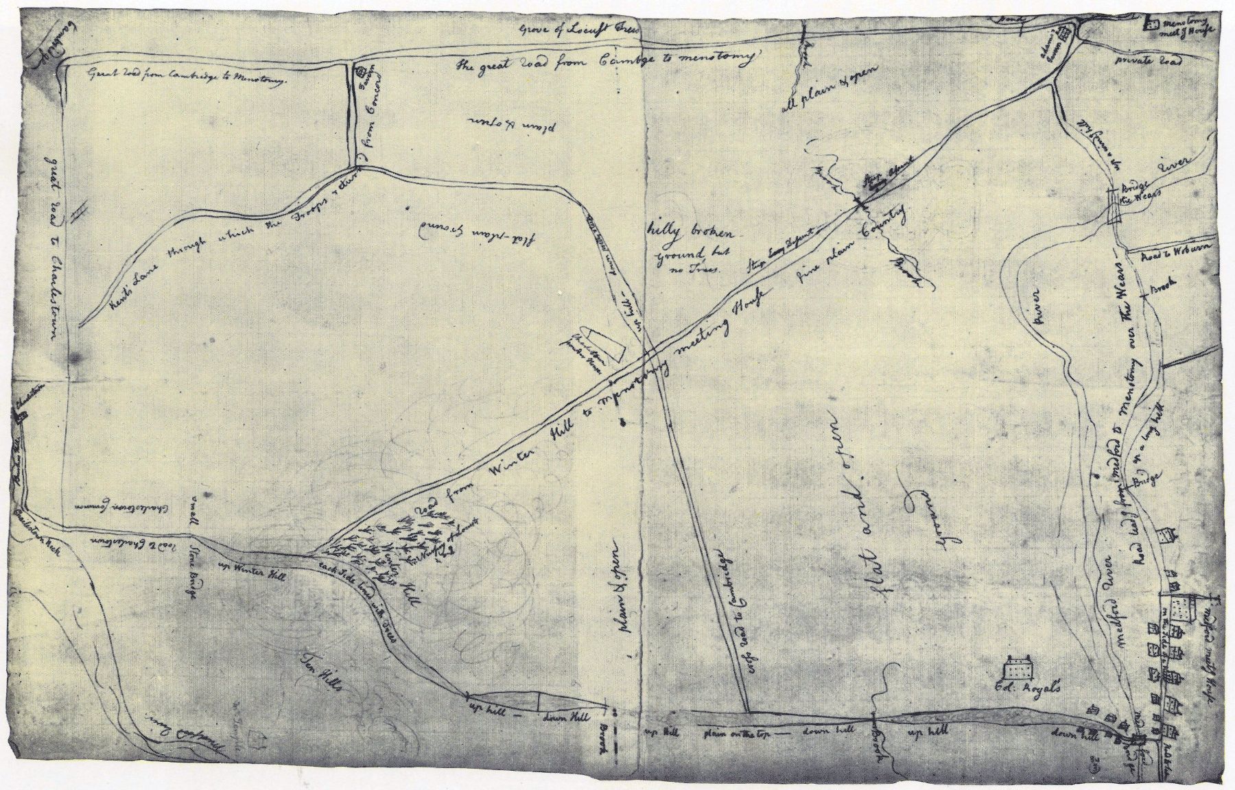
This pencil sketch done right after the fighting shows the Menotomy—Cambridge road as a straight line across the bottom. At a tavern at the edge of Cambridge, Percy, sensing an ambush ahead, wheeled left into Kent’s Lane toward Charlestown.
Return to “Rediscovering Hand-Drawn Maps from the Revolution and the English Duke Who Collected Them,” by Edwin S. Grosvenor, American Heritage, Summer 2019
Return to “The Treasure of Alnwick Castle,” by Elizabeth and William Cumming, American Heritage, August 1969
,
One of the Most Historically Significant Maps of the American Revolution
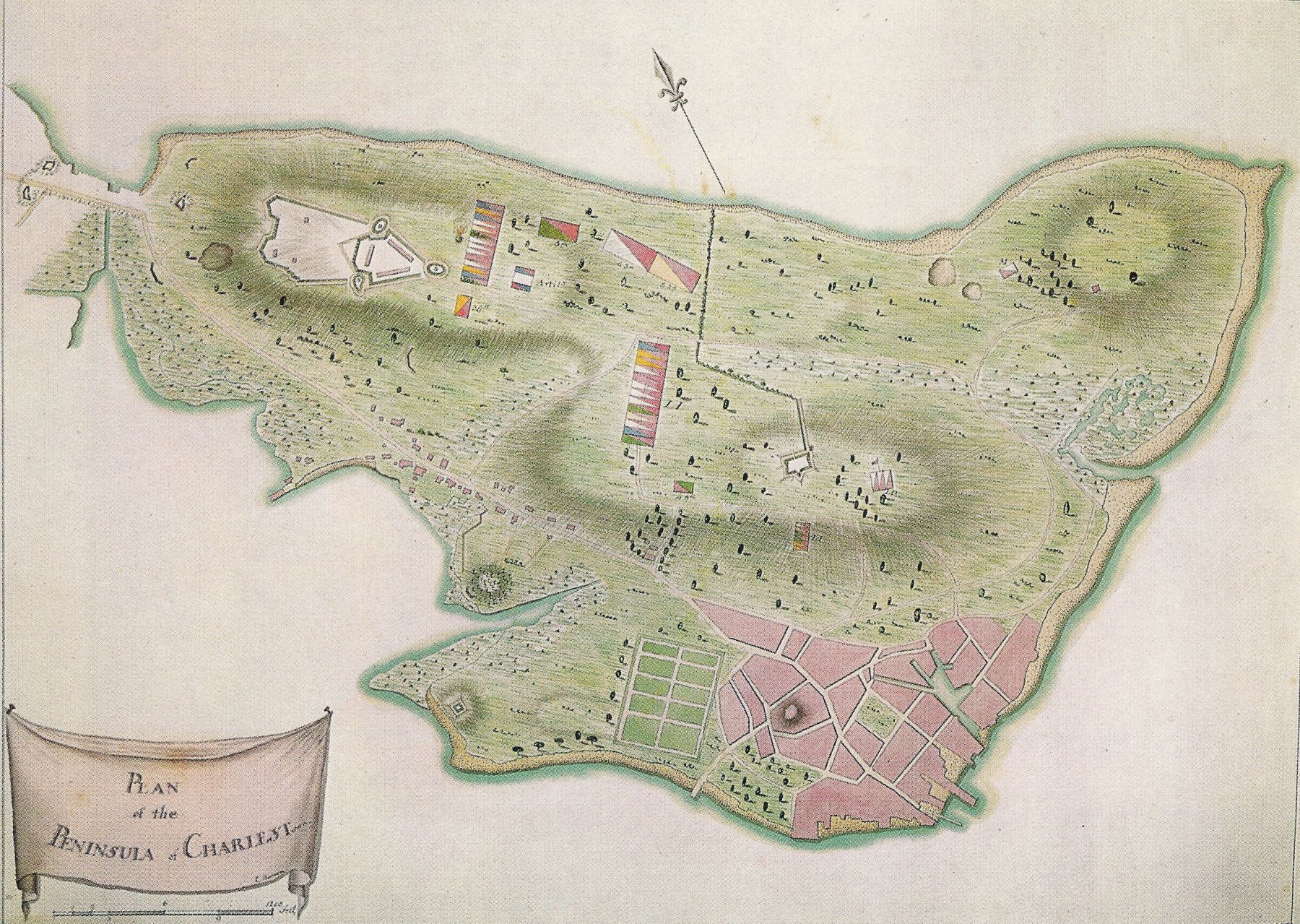
The “Plan of the Peninsula” above, drawn by Captain Edward Barron of the King’s Own Regiment, shows the Charlestown peninsula after the British had won the so-called Battle of Bunker Hill on June 17, 1775; actually the Point of attack was a small American redoubt on Breed’s Hill (right of center). Lord Percy was elsewhere that day. By the time this map was drawn the British had built a much bigger fort on higher Bunker Hill (left) and fortified Charlestown Neck behind it leading to the mainland.
Return to “Rediscovering Hand-Drawn Maps from the Revolution and the English Duke Who Collected Them,” by Edwin S. Grosvenor, American Heritage, Summer 2019
,
After Departing from the American Siege of Boston, Gen. Howe Regrouped at Halifax
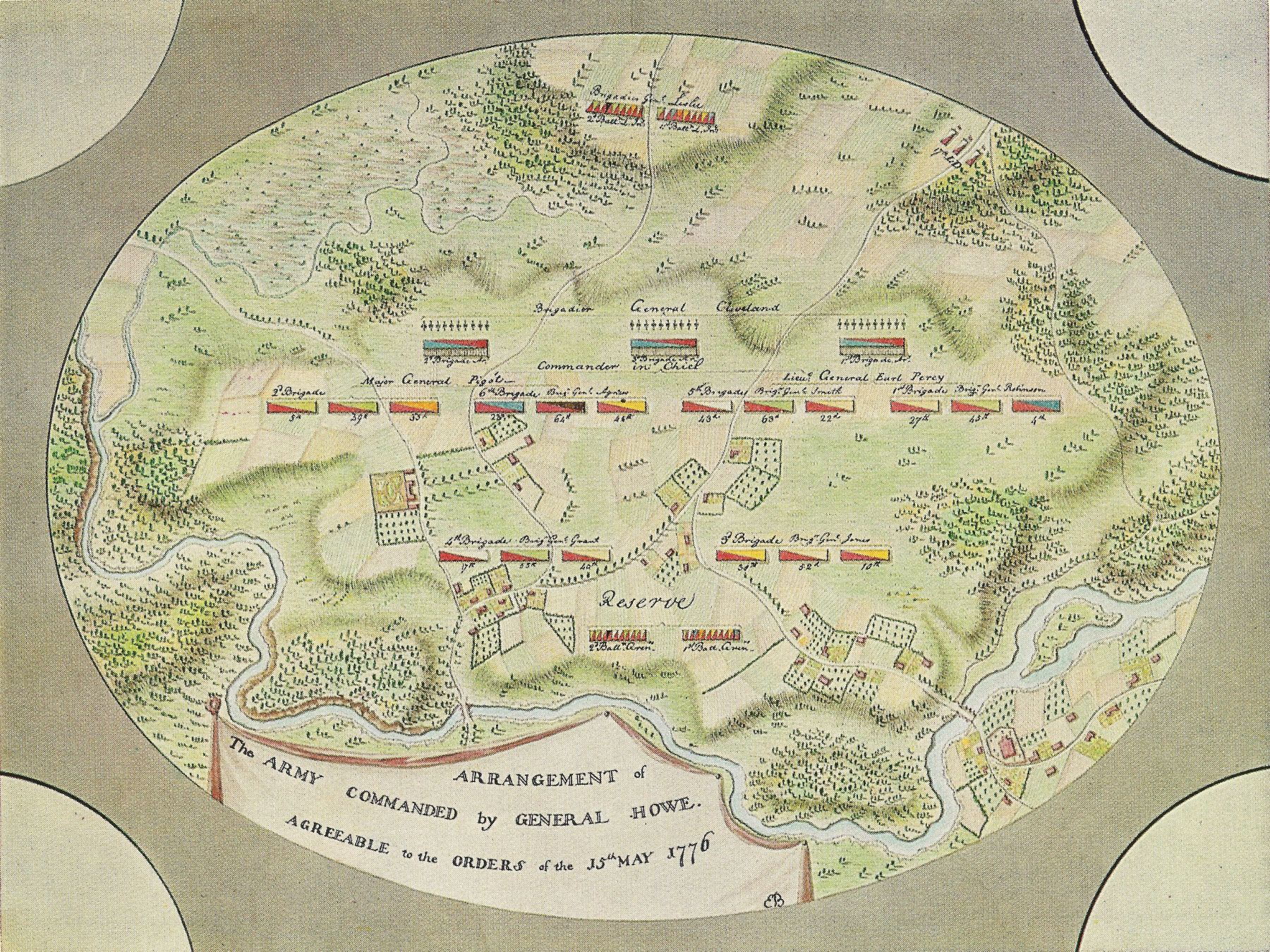
In May, 1776, General Howe, undisturbed in Halifax, Nova Scotia, exercised his troops “in line,” as depicted above by Edward Barron. Howe had been forced to evacuate Boston on March 17; at Halifax he prepared, with reinforcements, for the coming battle for New York. Percy’s name appears with his command. The map of Newport below was made by Lieutenant Thomas Fage, Royal Artillery, in January, 1779, and sent to Percy in England, where he had retired after helping capture Newport following his victory at Fort Washington.
Return to “Rediscovering Hand-Drawn Maps from the Revolution and the English Duke Who Collected Them,” by Edwin S. Grosvenor, American Heritage, Summer 2019
,
"There, that's the 1751 map of Virginia"
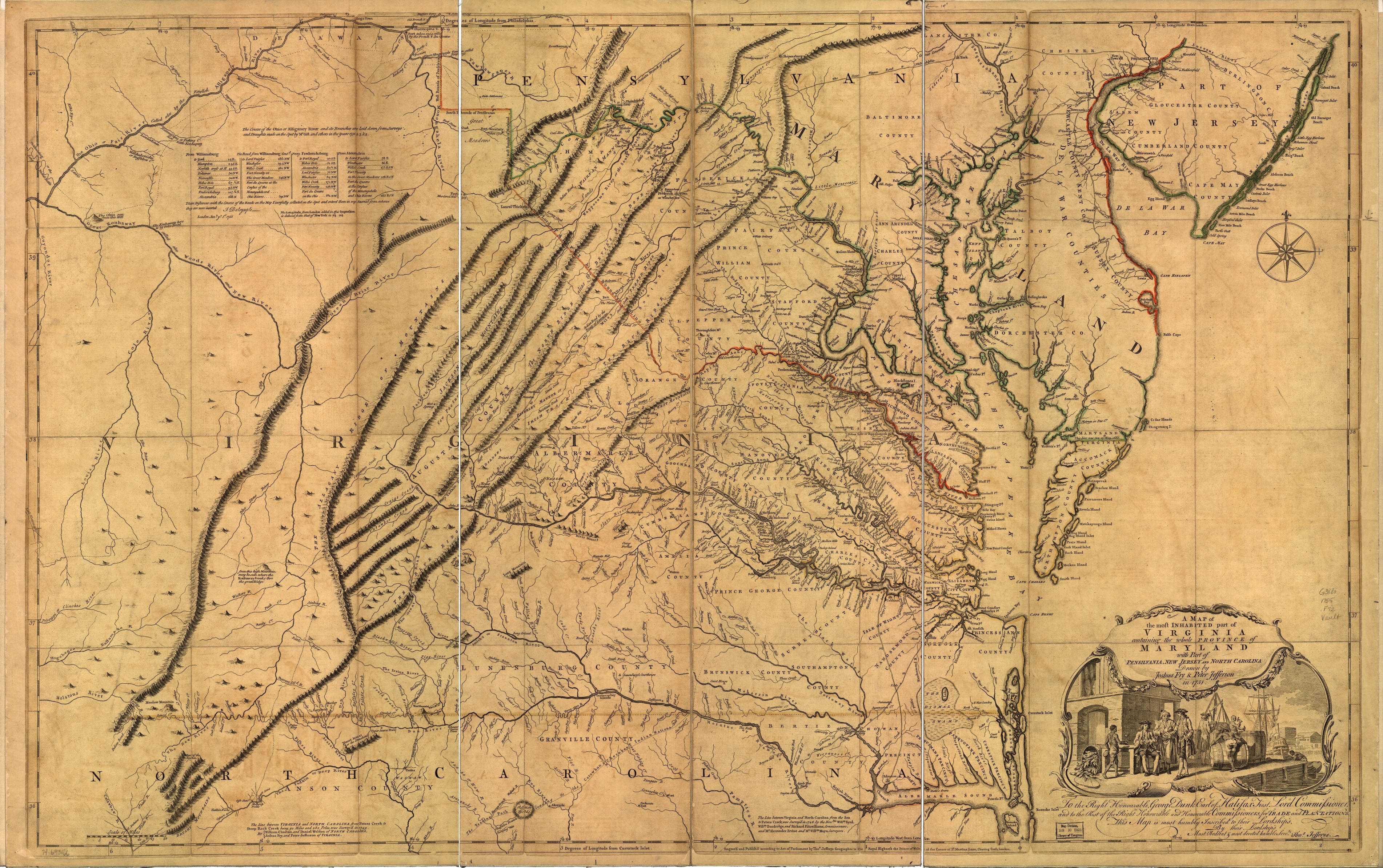
The American Heritage researchers were stunned when the Duke said, “There, that’s the 1751 map of Virginia.” Expert historians of cartography, they instantly realized it was one of only three copies in existence of the famous map of Viriginia surveyed and drawn by Roger Fry and Peter Jefferson, the father of Thomas Jefferson. The Library of Congress has a later edition of "A map of the most inhabited part of Virginia containing the whole province of Maryland with part of Pensilvania, New Jersey and North Carolina" (above).
,
The 11th Duke of Northumberland Lived in the Castle Where Harry Potter Was Later Filmed
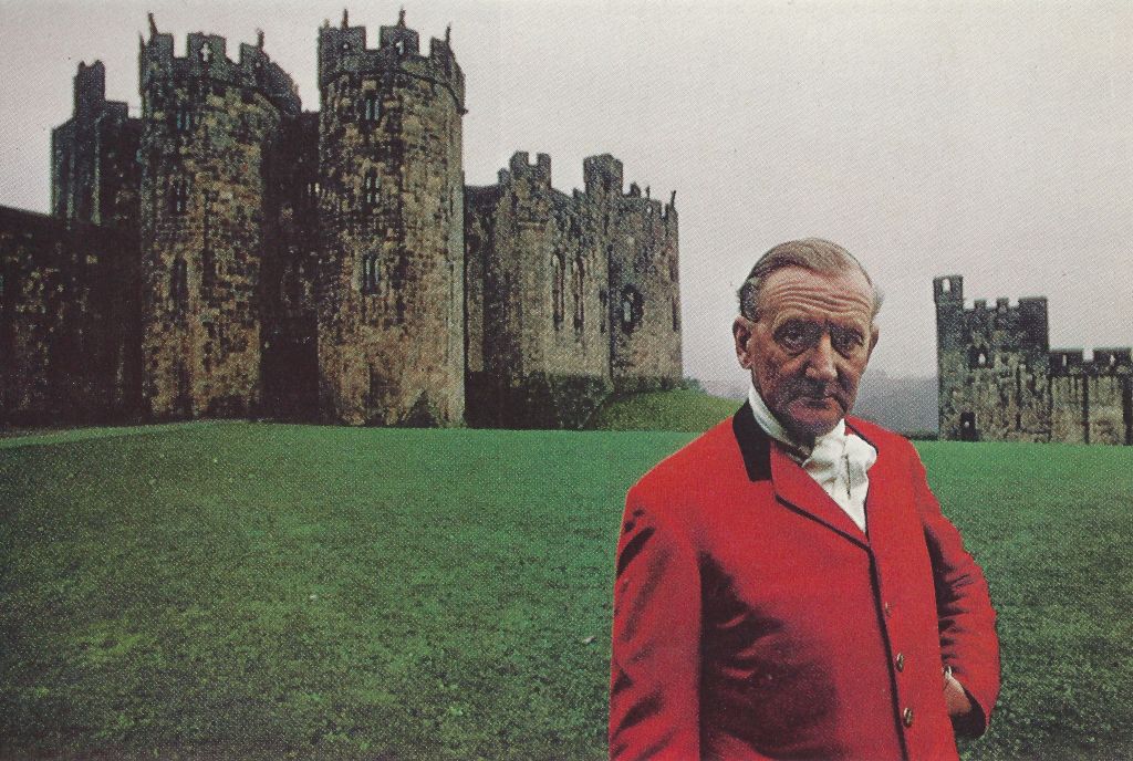
Sir Hugh Algernon Percy, K.G., tenth Duke of Northumberland and Baron of Alnwick, was photographed before one of the oldest sections of his sprawling castle. Photo by Anthony Howarth for American Heritage.
Return to “Rediscovering Hand-Drawn Maps from the Revolution and the English Duke Who Collected Them,” by Edwin S. Grosvenor, American Heritage, Summer 2019
Return to “The Treasure of Alnwick Castle,” by Elizabeth and William Cumming, American Heritage, August 1969
,
Harry Potter in Alnwick Castle
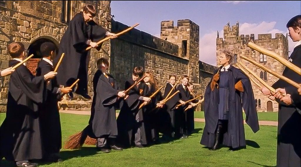
When Madam Hooch gave Harry Potter and his classmates lessons in riding a broomsticks at Hogwarts, they were actually in the courtyard of Alnwick Castle.
Return to “Rediscovering Hand-Drawn Maps from the Revolution and the English Duke Who Collected Them,” by Edwin S. Grosvenor, American Heritage, Summer 2019
Return to “The Treasure of Alnwick Castle,” by Elizabeth and William Cumming, American Heritage, August 1969