Now a popular state park, the unassuming geological feature along the Illinois River has served as the site of centuries of human habitation and discovery.
-
November 2020
5 years ago By Edwin S. Grosvenor Volume65Issue7
Editor's Note: Mark Walczynski is a retired professor at Illinois Valley Community College and the park historian for the Starved Rock Foundation, located at Starved Rock State Park in Utica, Illinois. His latest book is The History of Starved Rock (Cornell University Press, 2020), in which portions of this essay appear.
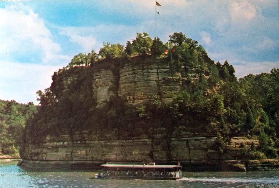
When Jolliet and Marquette made their expedition of the Mississippi in 1673, it introduced 17th century Canadian and French authorities to the potential for trade, colonization, and religious conversion in the Illinois Country, and more specifically to the Upper Illinois Valley. In fact, within a decade of the famous voyage, France would establish its furthest outpost in North America, called Fort St. Louis, along the shores of the upper Illinois River. They would choose for the site of the outpost one of the area’s most prominent geological features, a 125-feet-high isolated bluff located along the river’s south shore.
See also: "Marquette and Jolliet's Excellent Adventure," by Mark Walczynski
Today this site is known as Starved Rock, and it is home to one of the state’s most popular parks. Based in present-day LaSalle County, just two hours from Chicago, the park welcomes nearly three million visitors each year, both from across America and around the world. If the park were under federal authority, it would rank about eleventh in attendance of all national parks.
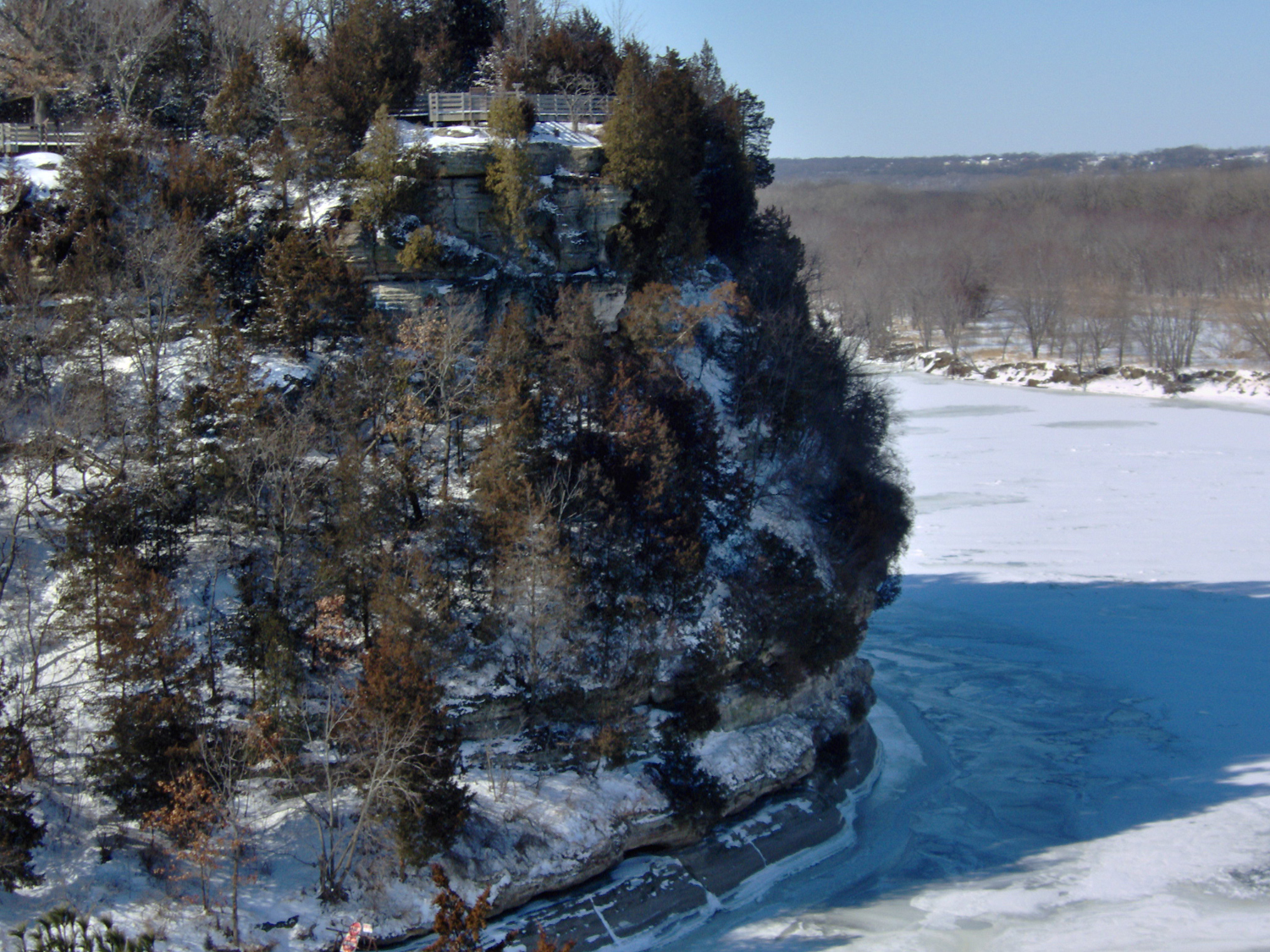
Starved Rock has a long history, much of which can be gleaned by visiting the park today. Geologically, the forces of nature exemplified by warming, cooling, and flooding carved and scraped Starved Rock into its current shape. Glaciers that had once spread across the North American continent had acted like huge, mile-high snowplows pushing debris, rocks, and other material from the north and into Illinois. We can see evidence of the glaciers' thrust south ward in glacial debris—formed “C-shaped” hills called moraines, where today on their summits, wind turbines harness another force of nature.
When the ice disappeared and the waters subsided, plants and animals again populated the valley. Archaeological excavations at the site reveal that Native Americans have visited, sojourned, and camped on the Rock for about 10,000 years. A few even interred their dead on the summit. Most researchers believe that these adaptive and industrious people, living in a culture in which iron and steel had yet to be introduced—from approximately 10,000 years ago until about the mid-1600s—made the best technology out of what nature provided, continually adapting and improving methods and tools they employed to kill fish and game, cook and store food, construct dwellings, and manufacture watercraft.
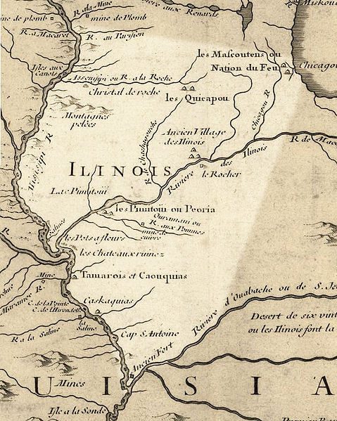
Oblivious to the movement of Europeans from the Old World to the New, the Indians in the Starved Rock area established a village named Kaskaskia, after the Illinois subtribe that lived there, just upstream from the Rock. European trade goods that made the chores of killing, cleaning, and cooking easier, reached the Kaskaskia a decade or so before French missionaries and traders made their debut at Starved Rock. Claude-Jean Allouez, a Jesuit missionary to the local Illinois Indians, reported in 1677 that the Illinois used the site and other nearby bluffs as lookouts.
Starved Rock itself takes its name from a nineteenth-century legend that describes the total destruction of the Illinois Indians by the tribe’s enemies, the Ottawa and Potawatomi, and in some accounts, the Kickapoo, Miami, and Winnebago, in retaliation for the Illinois murder of the Ottawa war chief, Pontiac. According to the legend, the allies of the slain war chief descended upon the Illinois Country, where they attacked the Illinois Indians who lived in villages located along the Illinois River. Pursued by their foe, the battered remnants of the Illinois tribe fled to the summit of Starved Rock where they were surrounded and besieged.
Without food or access to water, exposed to the elements, and, as described in one account, suffering from the horrors of smallpox, the starving and beleaguered Illinois attempted to escape their predicament by climbing down the side of the Rock at night, with both the cover of darkness and that of a violent thunderstorm. Having descended to the base of the Rock, the Illinois were discovered by their enemies and after a desperate struggle against overwhelming odds, were slain; the once powerful tribe of the Illinois from this point forward, according to the legend, ceased to exist. Fortunately, however, this alleged catastrophe is foreign to the well-documented historical record of the period and has no support from archaeology.
Starved Rock was known as Le Rocher to 17th and 18th century French explorers, missionaries, and travelers. Since that time Starved Rock and adjacent bluffs have been known as Little Rocks and Small Rocks, while Starved Rock itself was known as Rockfort and Little Rock. By the mid-1830s the bluff became known as Starved Rock.
Another early written reference to Starved Rock was penned by French explorer René-Robert Cavelier Sieur de La Salle in March 1680. In a directive to his second-in-command, Henri Tonti, who commanded a small, crude French outpost near today’s East Peoria, Illinois, known as Fort de Crèvecoeur, La Salle ordered Tonti to return to Kaskaskia, the large Illinois Indian village located about a mile upstream from Starved Rock that Jolliet and Marquette visited in 1673, “to visit a high rock, and to build a strong fort upon it.” Tonti obeyed La Salle’s orders; he surveyed Starved Rock, but while he was away, the disgruntled Frenchmen at de Crèvecoeur deserted. La Salle’s fort was not built on Starved Rock at this time.
Three years later, men working under the direction of Tonti began construction of Fort St. Louis during the early months of 1683. La Salle described his fort:
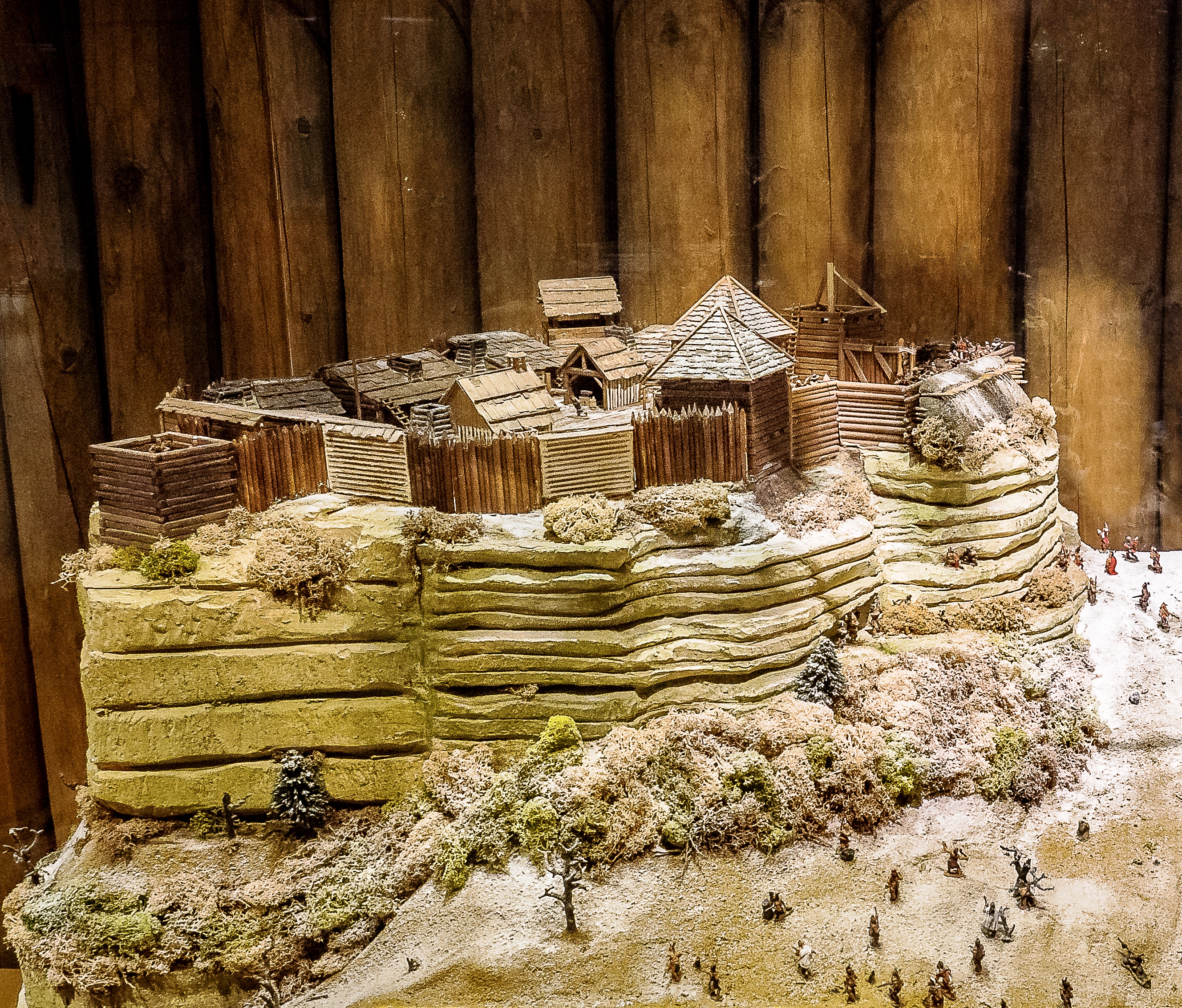
"This side [the south side] is enclosed with a palisade of white oak stakes eight to ten inches in diameter and twenty-two feet high, flanked by three redoubts made of squared beams set one above another to the same height, so placed that they all protect one another. The rest of the inclosure(sic) of the rock is surrounded by a similar palisade, only fifteen feet high because it is not accessible, flanked by four other redoubts, like the others behind the palisade. There is a parapet of great trees laid lengthwise one upon another to the height of two men, with the whole filled up with earth; and the top of the palisade is a sort of cheval-de-frise, with the points tipped with iron, to prevent escalade."
While the fort was under construction, La Salle convinced several Miami subtribes from today’s northwestern Indiana and southwestern Michigan to relocate to the Illinois River Valley. A band of Shawnee from the Ohio Valley and a group of Otoe, a trans-Mississippi tribe, also settled in the Illinois Valley. Tonti convinced the Illinois who had lived near Starved Rock but had been chased from their lands by Iroquois war parties to return to former Kaskaskia village. La Salle planned that his fort would become headquarters for trade, where tribesmen could exchange bison hides (La Salle’s royal license only allowed him to trade for bison hides) for items of European manufacture such as guns, knives, blankets, brass kettles, needles, and other goods. It would also serve as a center for French diplomacy in the region.
About 6000 Illinois Indians resettled at Kaskaskia in 1683. The village, also known today as the Grand Village of the Illinois State Historical Site, is located about a half mile east of Starved Rock and on the north side of the river along Dee Bennett Road. Although the site is owned by the State of Illinois, it is not yet open to the public. La Salle’s fort was abandoned by the French in 1691 when the local Amerindian groups relocated to other locales.
By the early 19th century, American frontier settlers would arrive and change the entire dynamic of the Starved Rock area. Their attitudes concerning the land, waterways, and their exploitation of natural resources, embodied values that would have seemed utterly foreign to the Indians who proceeded them.
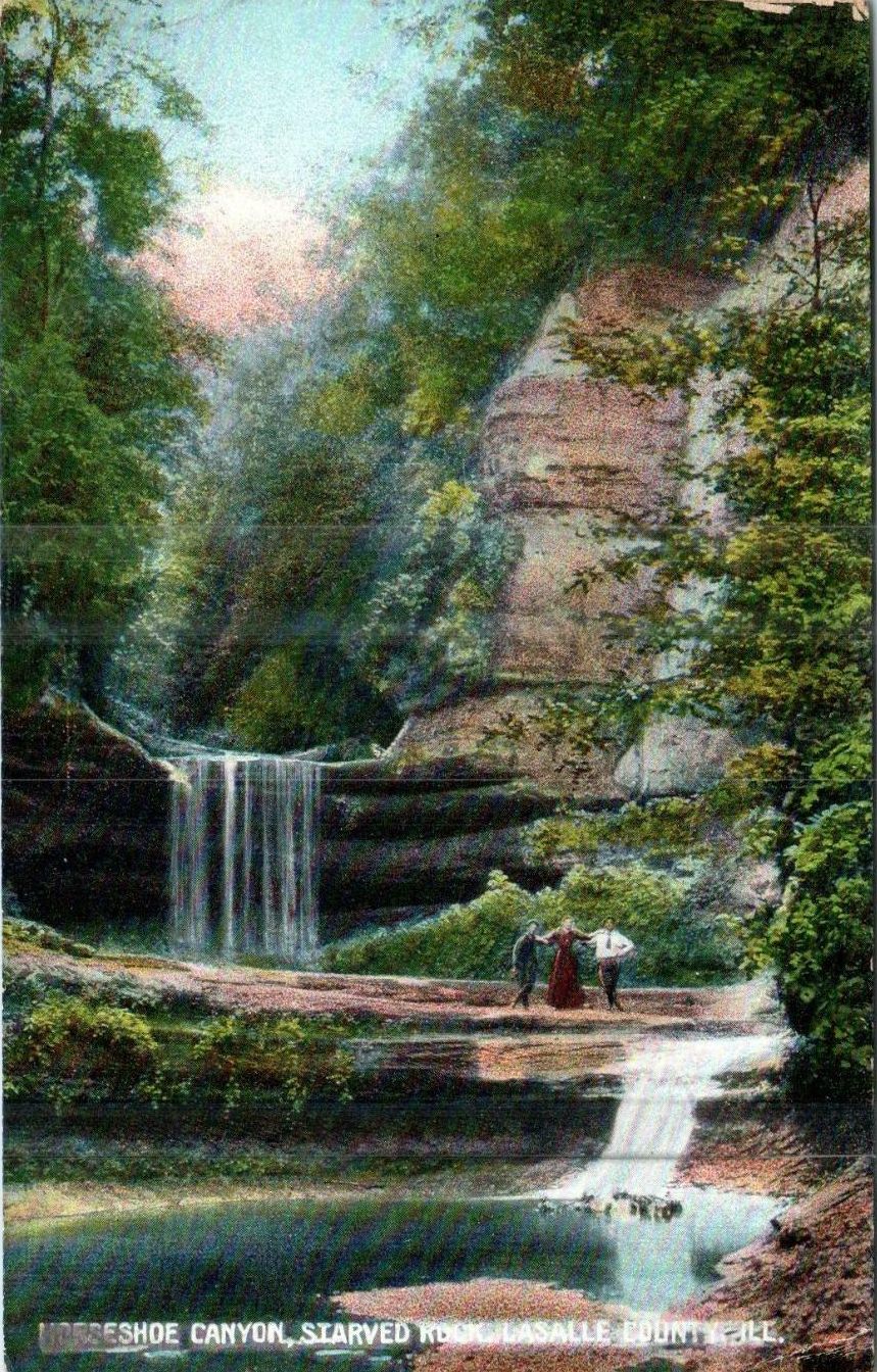
Today, Starved Rock State Park is one of Illinois’ most popular public parks. Purchased by the State of Illinois in 1911, and opened to the public in 1912, it has since grown from about 315 acres to 3,205, which includes a nature preserve located west of Illinois Route 178. Besides Starved Rock, the park’s attractions include fauna and flora, as well as many canyons and overlooks that can be viewed from approximately 13 miles of hiking trails. The Starved Rock Hotel, built in 1891, was an important place for visitors to stay and get a good meal.
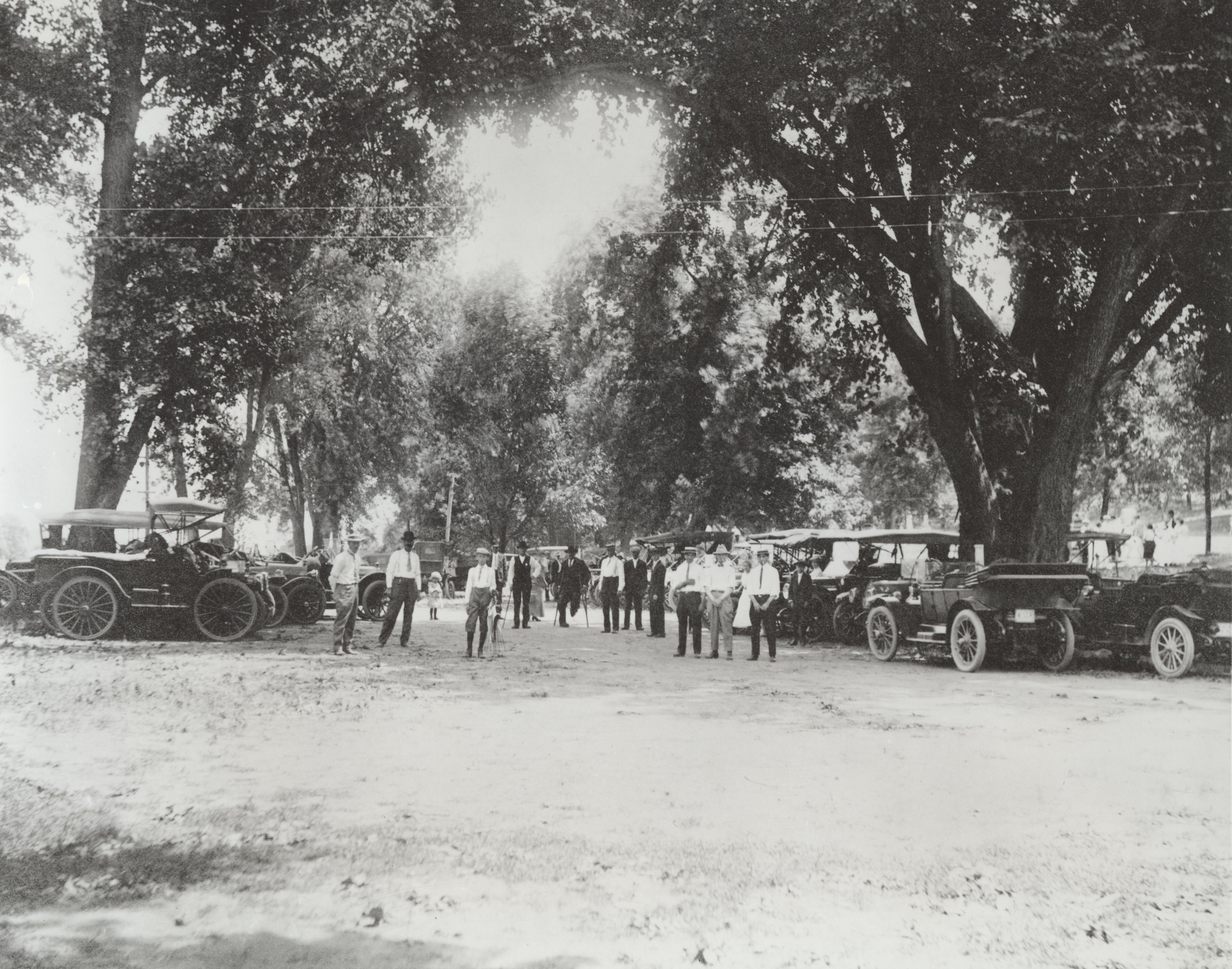
As a state park, Starved Rock has been visited by millions of people, many of whom have come to see the bald eagles, view the beautiful Illinois Valley, or simply to relax. Over Labor Day weekend, in 1923, Starved Rock State Park hosted over 50,000 visitors, many of whom drove to the site in simple automobiles—10,000 of them—over narrow country roads.
The famous bluff itself was designated a National Historic Landmark in 1962. Although fishermen, hunters, birders, hikers, photographers, picnickers, and artists can be seen throughout the park on any given day, every now and then a few curious individuals come to the park to learn about the Rock's past. They view the site through the eyes of inquisitive historians. For them, the Starved Rock Visitor Center has displays such as the Newell Fort exhibit, historical videos, and a bookstore that sells several well-written and scholarly books on the Rock's past. The Starved Rock Foundation conducts guided hikes that give park visitors insightful and informative tours of the cliffs and canyons.
If you go...
- Stop at the Starved Rock Visitor's Center, where you'll find trail maps of the area, informational videos and brochures, and educational displays to help get acquainted with the park's history and geology. The center is open 9-4 daily (though is currently closed due to COVID-19).
- Hike to LaSalle Canyon, regarded as one of the most beautiful natural features around Starved Rock. The 2.6 mile trek begins at Parkman's Plane and follows the River Trail. See more details here.
- Stay at the Starved Rock Lodge, a historic four-star hotel built by the Civilian Conservation Corps in 1938 and opened to the public in 1939. Amenities include a woodsy restaurant, a cafe, and a bar, plus live entertainment.
For visitor information about the park, be sure to visit the Illinois Department of Natural Resources website.