A team from American Heritage helped document some of the most important maps of the Revolution — still stored in the medieval English castle where scenes from Harry Potter were later filmed.
-
Summer 2019
7 years ago By Edwin S. Grosvenor Volume64Issue3
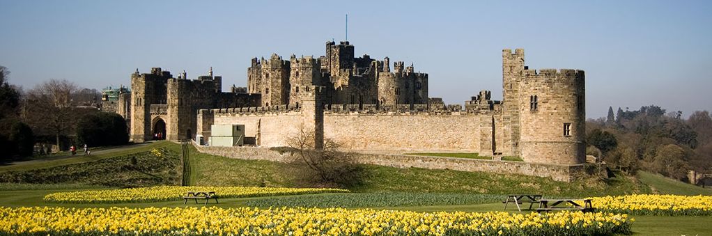
Alnwick (pronounced "Ań-nick) is best known as the castle where the Harry Potter movies were filmed, where Hogwarts students learned to fly broomsticks and play Quidditch among its high castellated towers.
 Begun in 1096 in the far northeast corner of England, Alnwick Castle helped guard the frontier against incursions by Scottish clans. Today, some 800,000 visitors each year come to enjoy jousting, archery contests, and court jesters, as well as various Harry Potter-themed events and games, including lessons in broomstick-riding. Other visitors, more inclined to the fine and decorative arts, can view one of the most important private collections in the U.K., with paintings by Titian, Van Dyck, and Canaletto, and ceramics by Meissen, Sèvres, and Minton. The gardens on the grounds are also considered some of the finest in England.
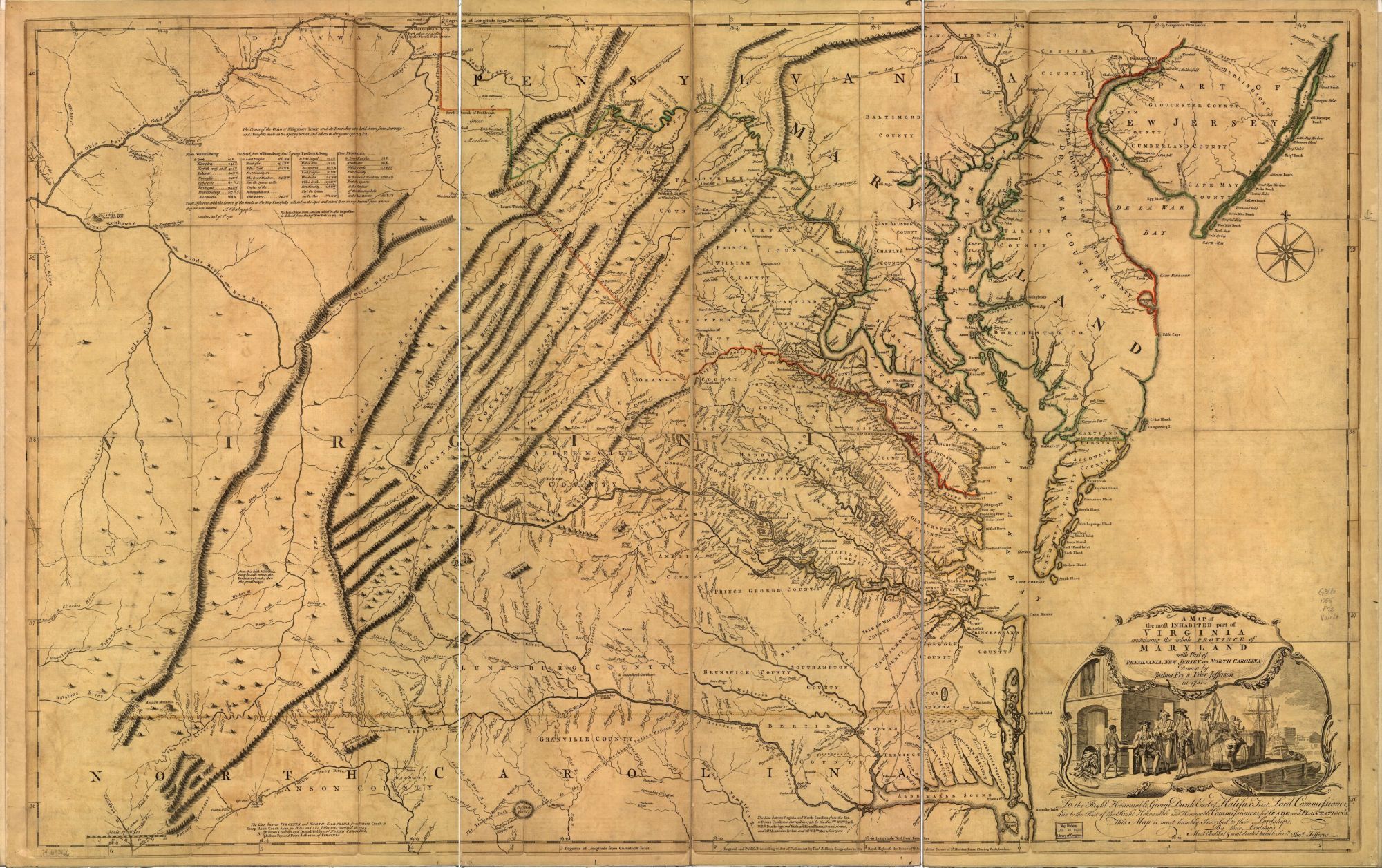
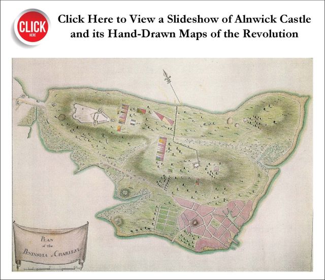
But, for Americans, the real treasures at Alnwick are its one-of-a-kind maps of the American Revolution, drawn by hand during or just after important battles such as Lexington, Concord, Bunker Hill, Long Island, and Fort Washington.
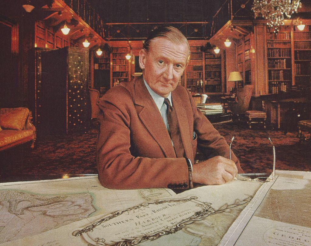
In 1969, the 10th Duke of Northumberland, the owner of Alnwick, invited a team of researchers from American Heritage, Elizabeth and William Cummings, to help him catalogue his maps, which had lain largely forgotten in an old metal box. Some of the most important maps they found were published for the first time in our August 1969 issue.
See the entire original article Treasures of Alnwick Castle by Elizabeth and Matthew Cumming
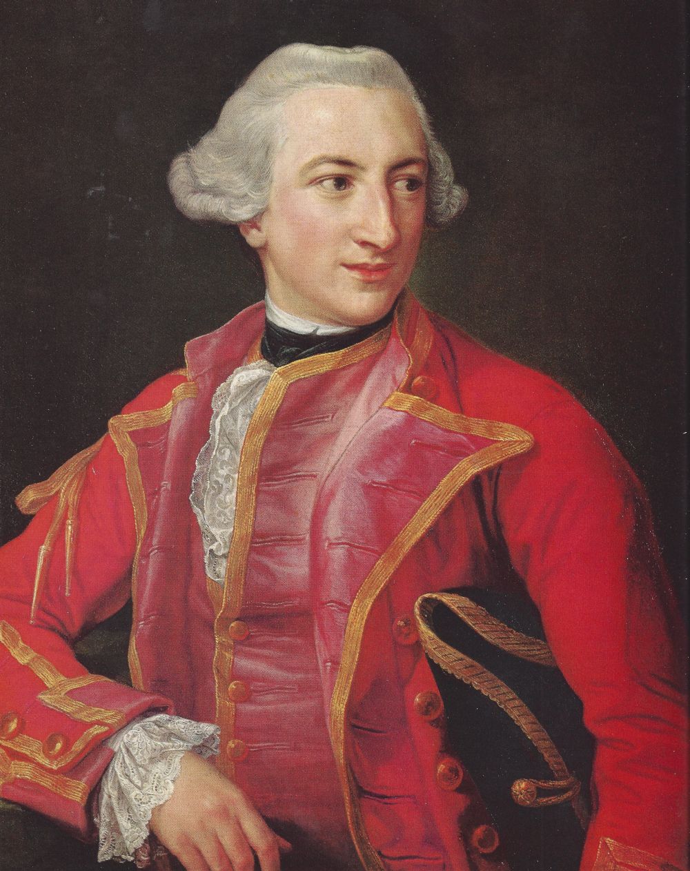
Hugh Percy (1742–1817) joined the British Army as a teenager and rose to the rank of lieutenant general by the time he commanded some of the forces occupying Boston in 1775. Later a British peer and the 2nd Duke of Northumberland, he fought at the battles of Lexington, Concord, Long Island, and Fort Washington during the Revolution. Gen. Percy is widely credited with saving the British forces who were ambushed by the Americans at Concord by rushing reinforcements to the battle.
Percy wrote that, "during the whole affair, the rebels attacked us in a very scattered, irregular manner, but with perseverance and resolution; nor did they ever dare to form into a regular body. Indeed, they knew too well what was proper to do so. Whoever looks upon them as an irregular mob will find himself very much mistaken. They have men amongst them who know very well what they are about, having been employed as rangers against the Indians and Canadians, and this country being very much covered with wood, and hilly, is very advantageous for their method of fighting."
Percy later fought at Long Island and Fort Washington. A Whig who sympathized with the colonists to a degree, he resigned his command in 1777 due to disagreements with his superior, General William Howe. Percy returned to England with his priceless collection of maps of the battles in which he had fought. They still remain in the family.
There's another curious connection between America and the Percy family. A famous but "illegitimate" member of the family was James Smithson, whose bequest founded the Smithsonian Institution. The first Duke of Northumberland was Hugh Percy (1714–1786), an English peer, landowner, and art patron. Percy was actually born Hugh Smithson, the son of Langdale Smithson of Langdale, Yorkshire. After he married Lady Elizabeth Seymour, the Baroness Percy, he changed his name to Percy. James Smithson was the duke’s illegitimate son, the result of an affair between Percy and Elizabeth Hungerford Macie. (For an intriguing story of how Smithson's grave was robbed by Alexander Graham Bell, and then his remains were brought to the U.S. for proper recognition, see "Digging up James Smithson" in the Summer 2012 issue of American Heritage.)